15 COLTON ST
Owner Information
LONG,REX A + LAURA A
0015 COLTON ST
WORCESTER, MA 01610 2609


Property Details
15 COLTON ST is classified as a Single Family Residential (Conventional).
The primary structure on this property was built in 1890. There are 2,694ft2 of built area within this property. There is 1,303ft2 of residential/living space within this property. This property is listed as having 5 rooms.
15 COLTON ST is valued at $171,300. The land is valued at $30,000 and the structures are valued at $141,300.
This property is in Zone RG-5. Confirm with local Zoning Board authorities to ensure there are no overlays or other easements on this property.
The most recent deed for 15 COLTON ST is recorded at the local registrar in Book 18135, Page 0191. 15 COLTON ST was last sold on Thursday, August 1, 1996 for $67,500.
Assessment data from fiscal year 2021.
Flood Data
This property is completely within the AE Zone (within floodplain).
The base flood elevation for this flood zone is 449 feet.
This information is sourced from the FEMA National Flood Hazard Layer. See our full disclamer.
Broadband Internet Providers
| Provider | Type | Bandwidth (mbps) | |
|---|---|---|---|
| Crown Castle Fiber | Fiber | 0 | 0 |
| Viasat Inc | Satellite | 100 | 3 |
| Verizon New England Inc. | DSL | 10 | 1 |
| Charter Communications Inc | Cable | 940 | 35 |
| T-Mobile | Fixed Wireless | 25 | 3 |
| GCI Communication Corp. | Satellite | 0 | 0 |
| HughesNet | Satellite | 25 | 3 |
| VSAT Systems, LLC. | Satellite | 2 | 1 |
Broadband service provider data from December 2020.
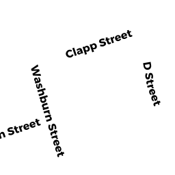
Adjacent Properties
- 22 WASHBURN ST
Apartments with Four to Eight Units owned by SAFFRON PROPERTIES LLC - 20 WASHBURN ST
Single Family Residential owned by HUYNH,DONG T + LAM,TINA T - 12 WASHBURN ST
Other Storage, Warehouse, and Distribution facilities (see also usecode 401) owned by VAILANCOURT,STEVEN P + LISA I - 10 WASHBURN ST
Three-Family Residential owned by HINES,EDWARD T + - 10 WASHBURN ST
Two-Family Residential owned by HINES,EDWARD T & K JACHIMCZYK - 13 COLTON ST
Two-Family Residential owned by GASEK,JANE A +